Dairyland Dare
April 2009
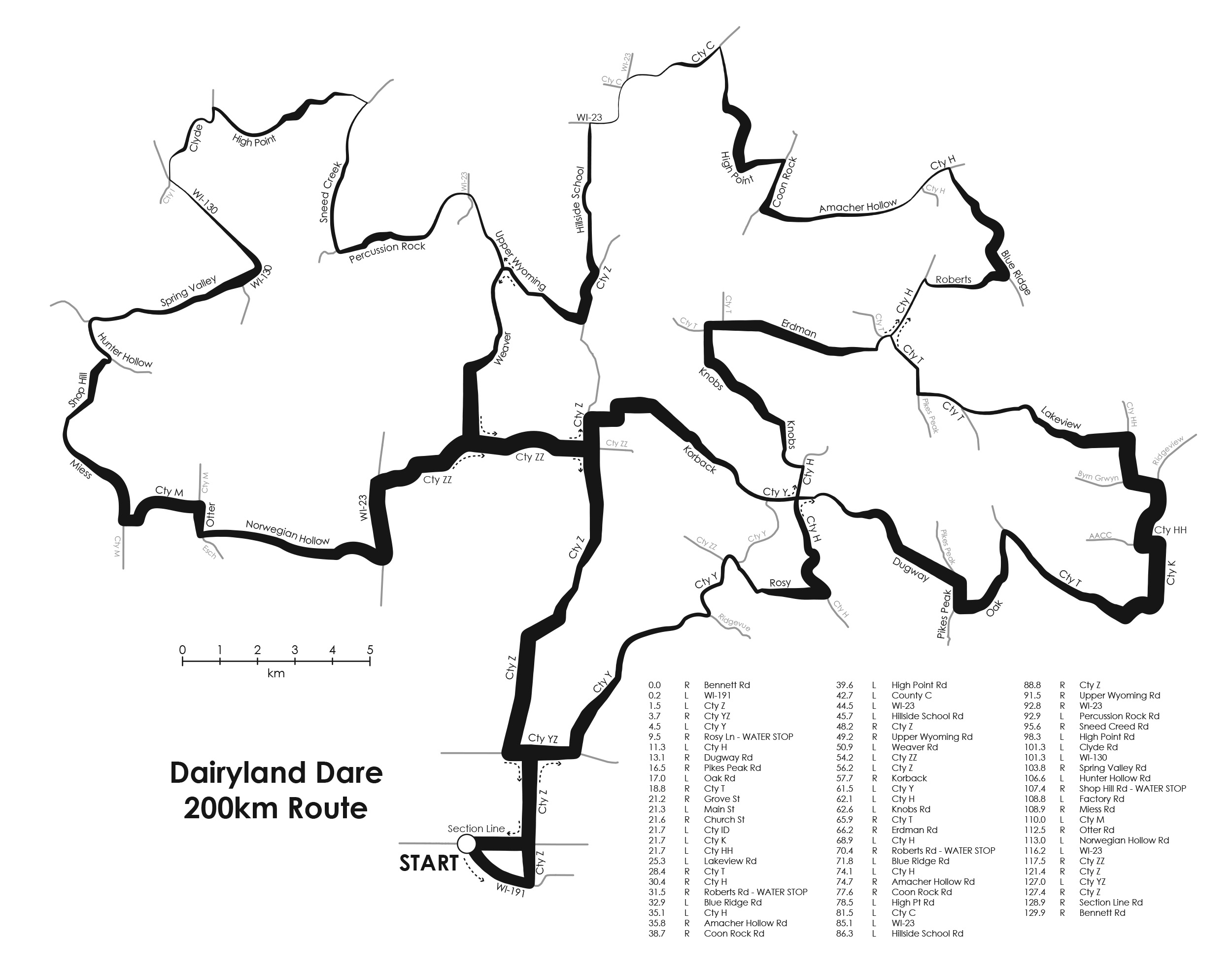
My roommate asked me to come up with a better kind of bike map, one that gave him a better idea of the hills and valleys of the route. This is what I made for him: a map of a local event he was planning on competing in, where the elevation along the path is indicated by line width, which means you can easily interpret the slope and facing direction of any hills. I go on at some length about the advantages and disadvantages of this technique in a guest post on the
Axis Maps blog, and in the
Spring 2009 issue of
Cartographic Perspectives, if you’re interested in learning more. I call it linear terrain encoding.
I didn’t manage to get around to including a legend, partly because this was more of a technique-test map than anything.