Flight Map
March 2018Best Private Sector Map, WLIA 2019
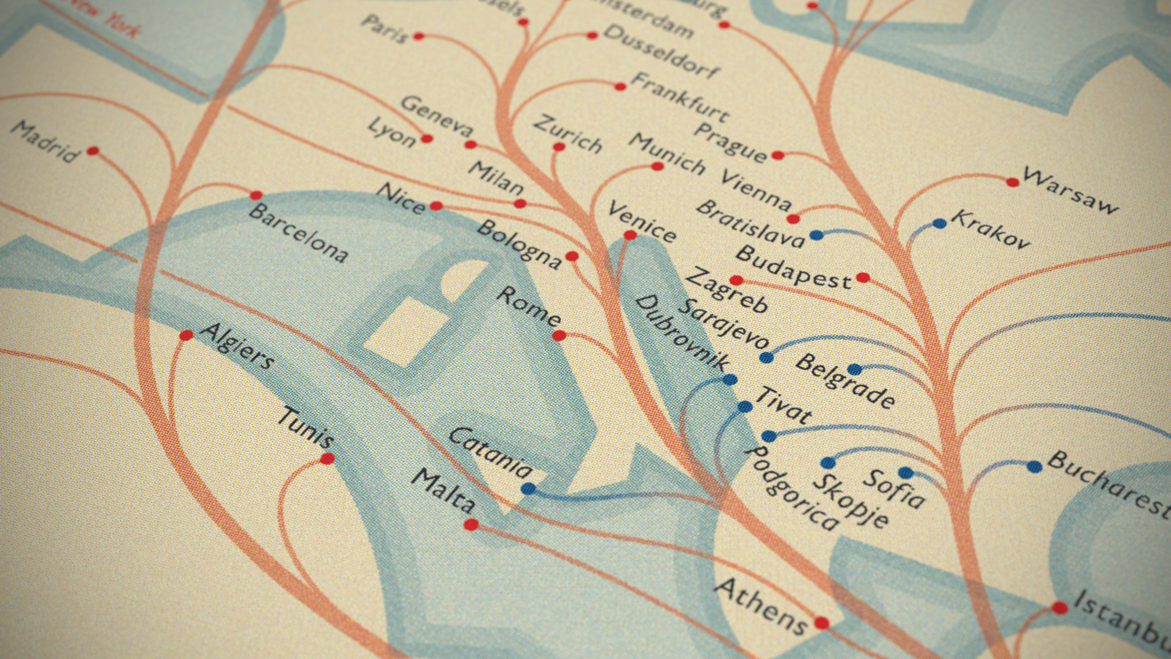
I had a chance to redesign the route map for the in-flight magazine of a major airline, which shows everywhere the airline flies, plus destinations you can reach via one of their major codeshare partners. This is an iteration that I explored early on in that process. You can read more about it on my blog.
Given that many of their routes were clustered in Europe and the Middle East, I decided to try out a cartogram, significantly distorting various landmasses in order to make space, and shrinking/moving those that had fewer flights. The Arabian Peninsula is huge now, and Europe is greatly inflated, while the Americas are compressed some. I also stretched out parts of Asia across the gutter. There's a lot of distortion, but I think it's still largely recognizable.
The root-and-branch style of route lines is intended to dodge a common problem with airline route maps: often there is a mass of individual route lines between each city, so numerous that it's impossible to trace along each one. So I have bundled them, hopefully making each connection easier to follow visually to its destination. To be fair, I'm helped by the fact that most routes go to Dubai, but it's still useful even in this case.