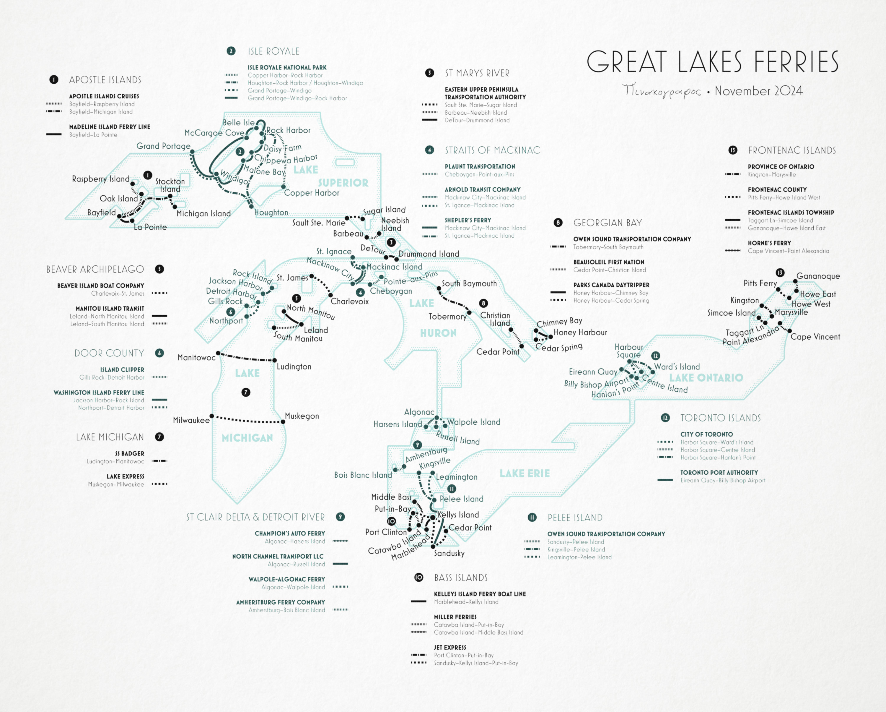
Great Lakes Ferries
November 2024A conversation on Mastodon with an old friend led me to wonder about the state of ferries on the Great Lakes, and to make a transit map for them. There were more than I expected.
I set myself the challenge of using only two ink colors, and trying to fit everything into a single map with no insets (despite the fact that I had to show ferry lines that were a few dozen meters long, alongside some that were dozens of km).
The result was a fun exercise. Not the greatest transit map, but one where I got to learn a few things.
I posted about the map’s construction live on Bluesky if you want to have a look at how it came together.