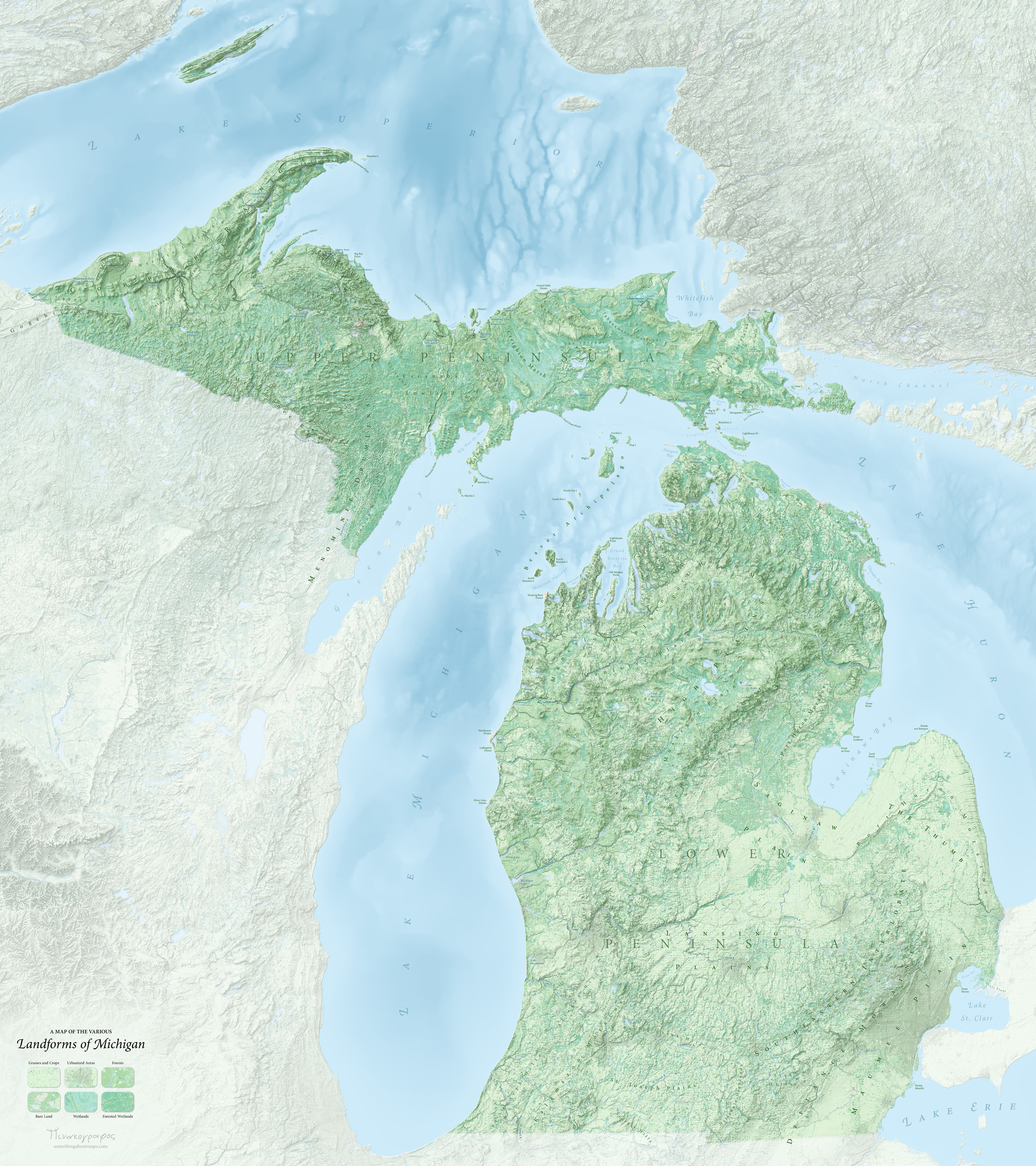
Landforms of Michigan
April 2020Best of Show & Best Reference Map: CaGIS 2021
1st Place (Basemap) & President's Choice: WLIA 2015
Selected for the Atlas of Design
I began this project in 2014, and pretty much finished it in 2015. But, I let the last few changes linger for five years; it can be hard for me to return to unfinished projects.
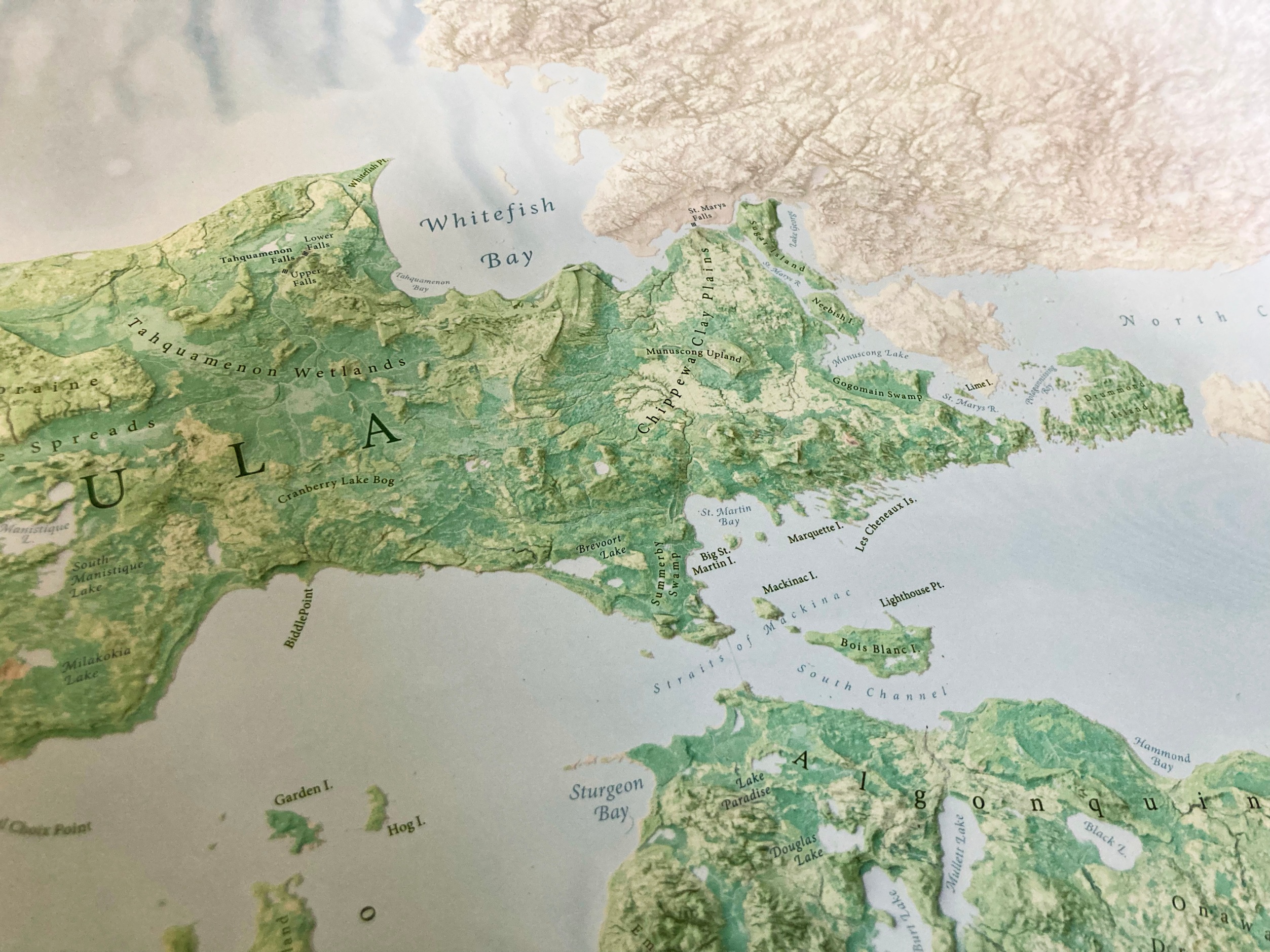
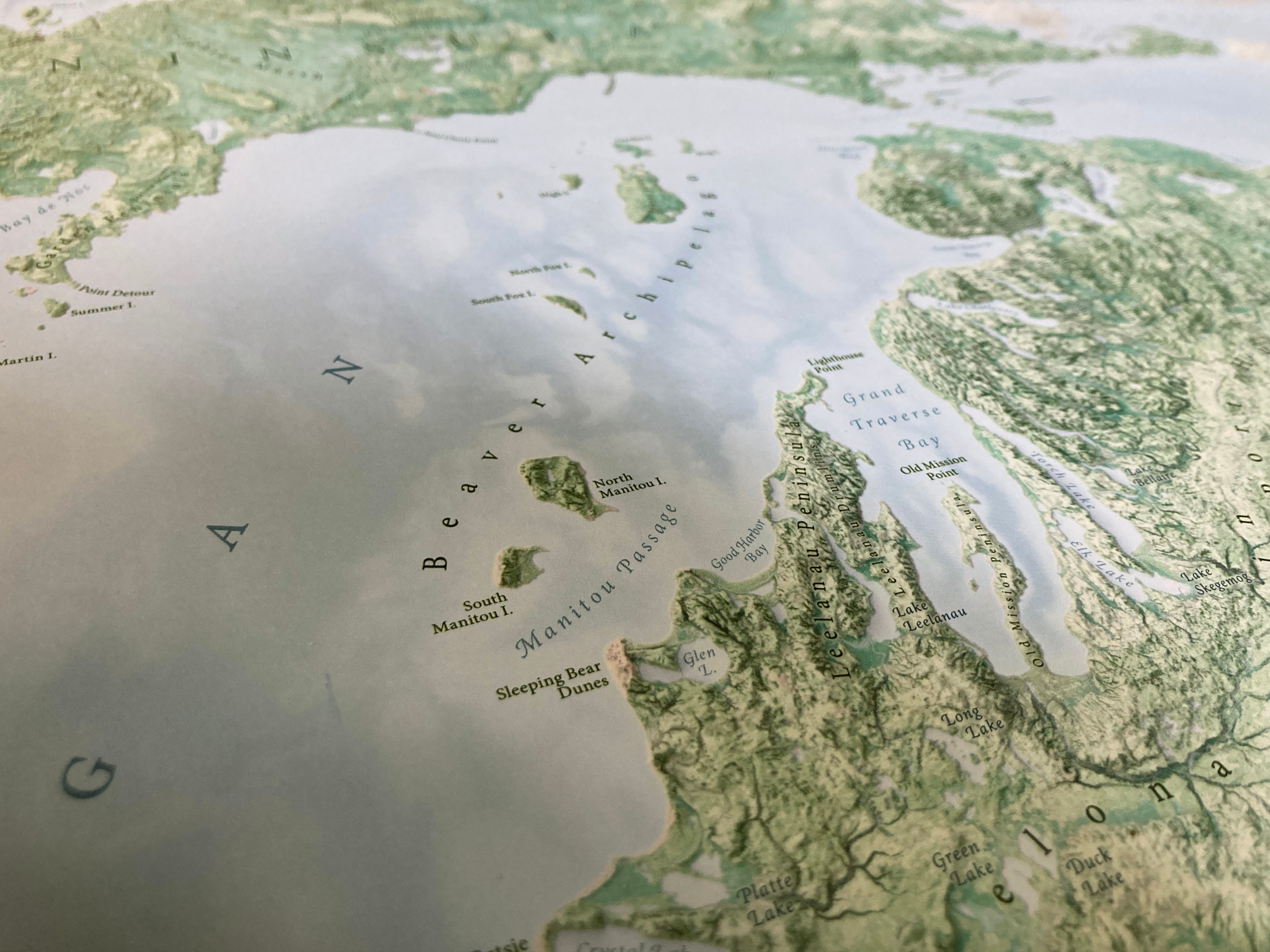
It is a love song to my homeland, a chance to better learn its grammar. I probably spent as much time collecting, researching, and occasionally coining toponyms as I did on the actual map design, because I think many of the state’s features deserve more than anonymity.
You can find a higher resolution version, and some notes, by clicking here. (You’ll also find a link to purchase a copy, if that’s something you might be interested in.)