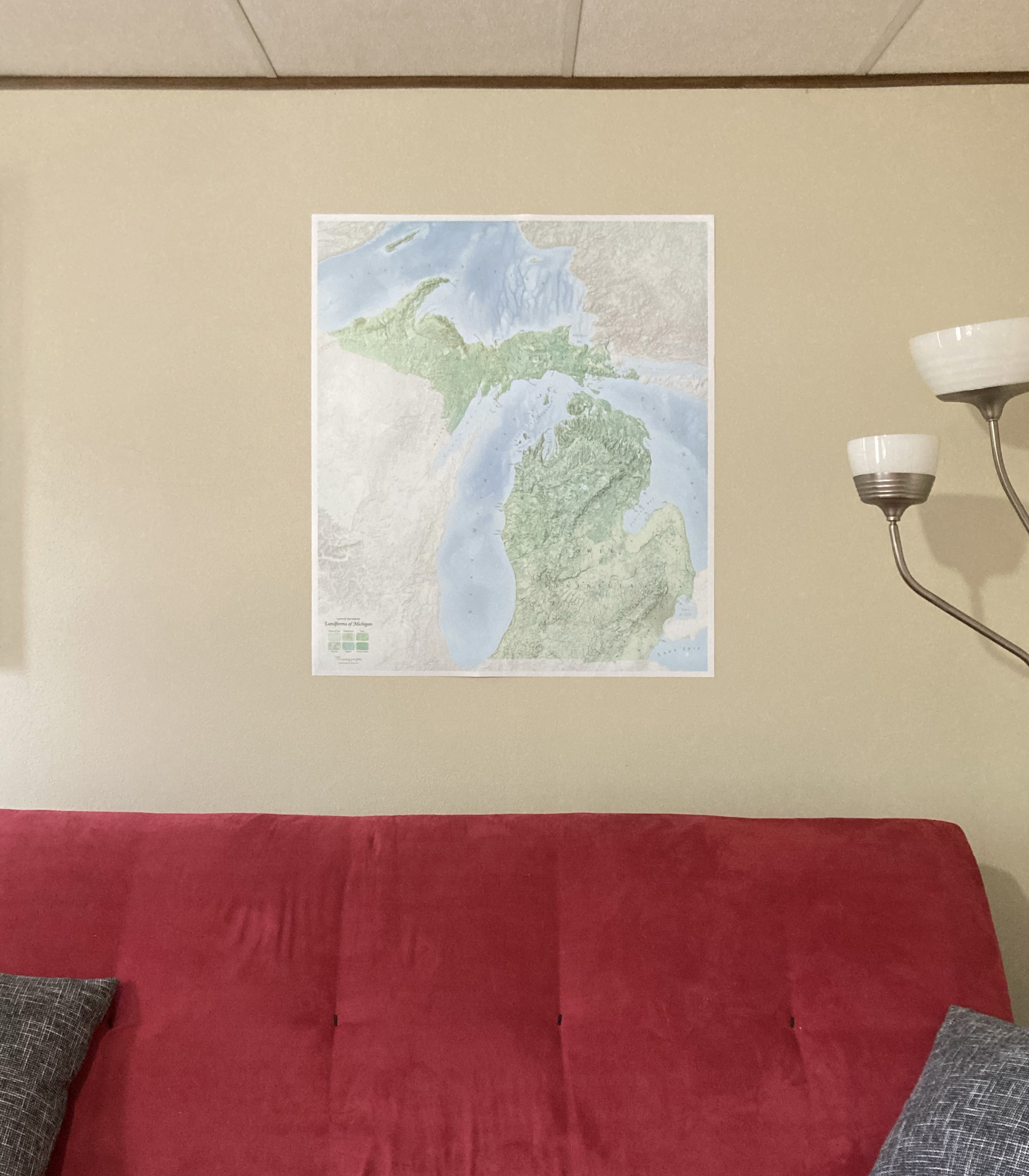
Landforms of Michigan
Physical Portrait of a StateAwarded Best in Show & Best Reference Map, 2021 CaGIS Awards
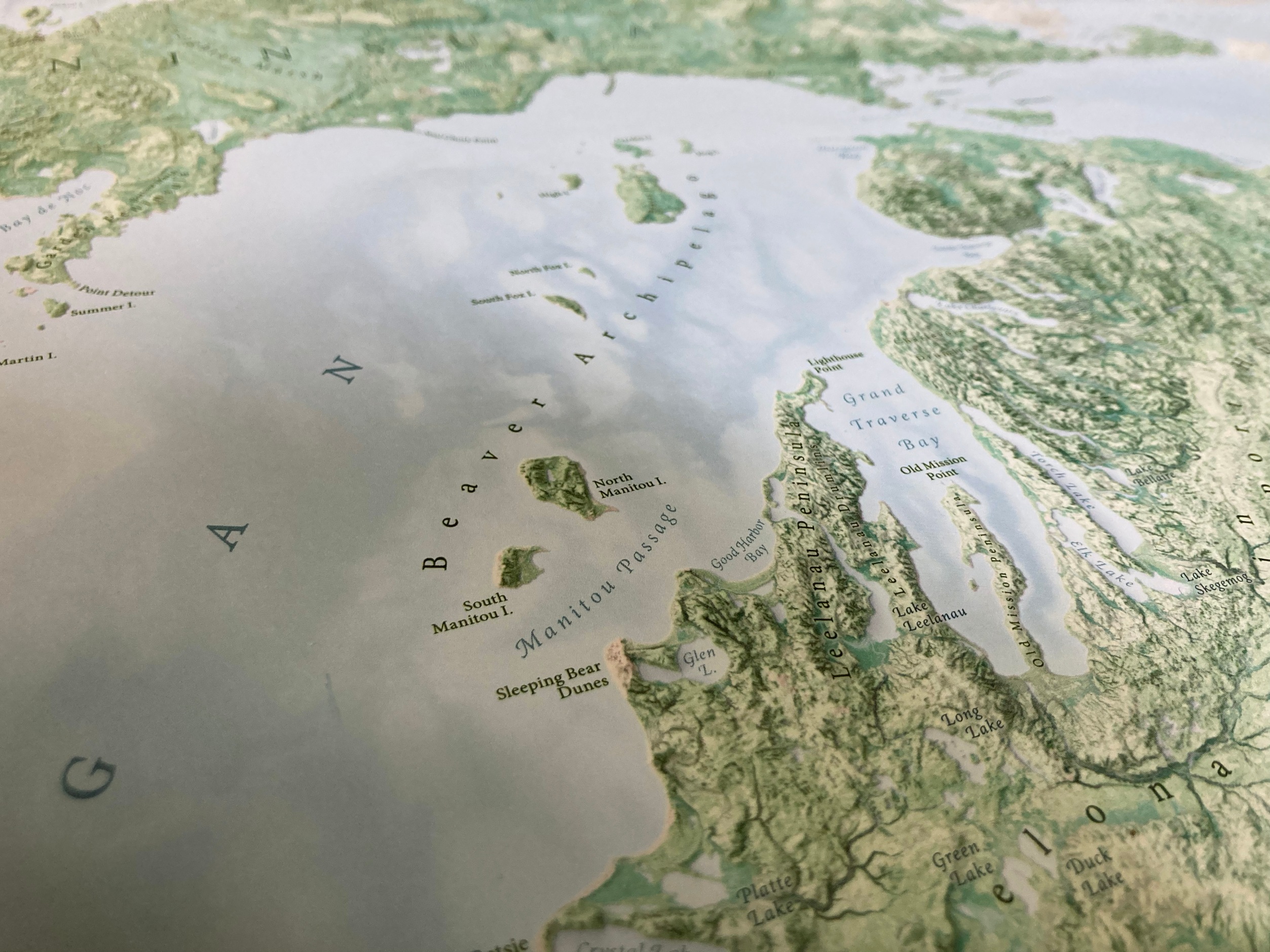
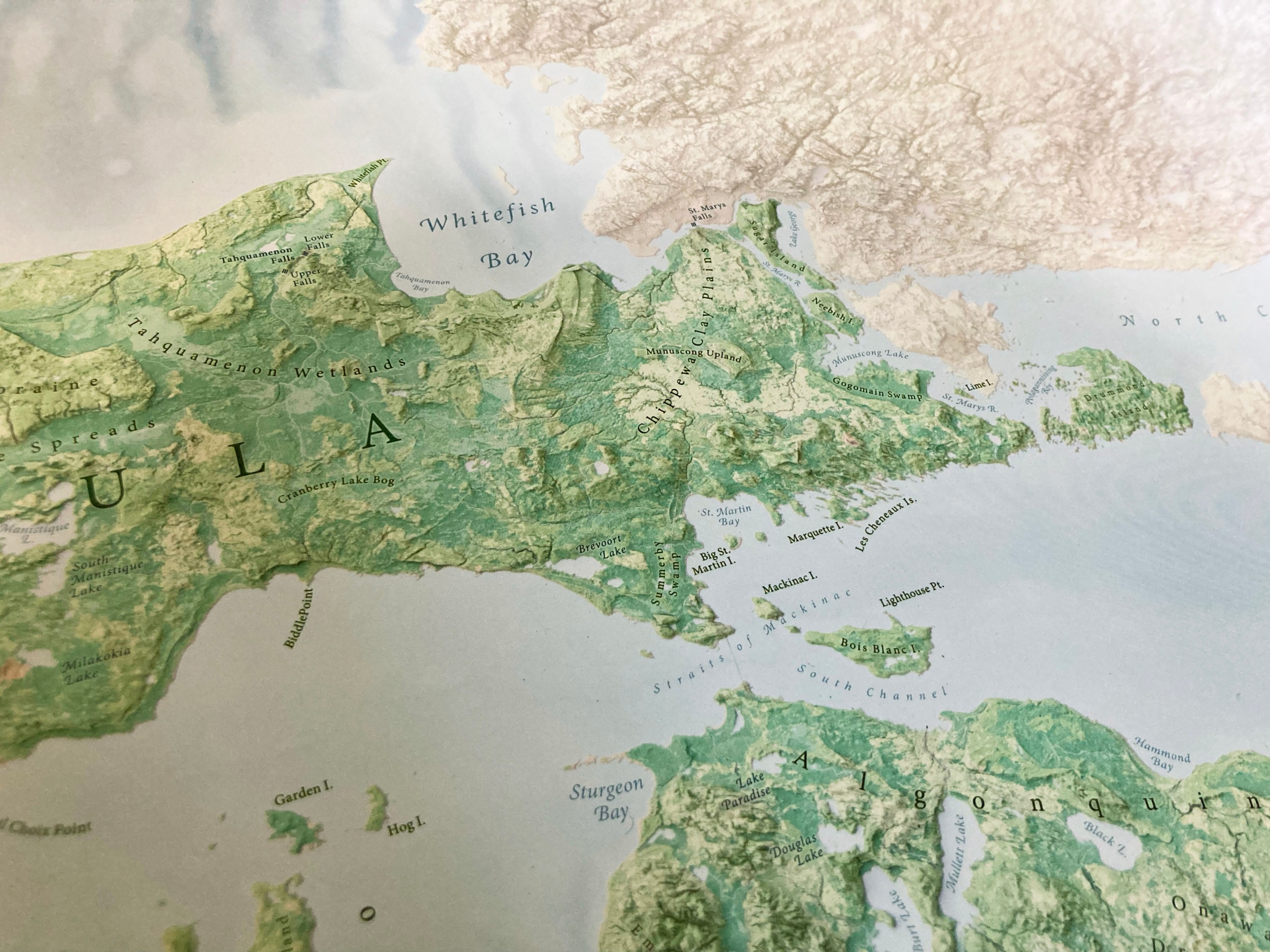
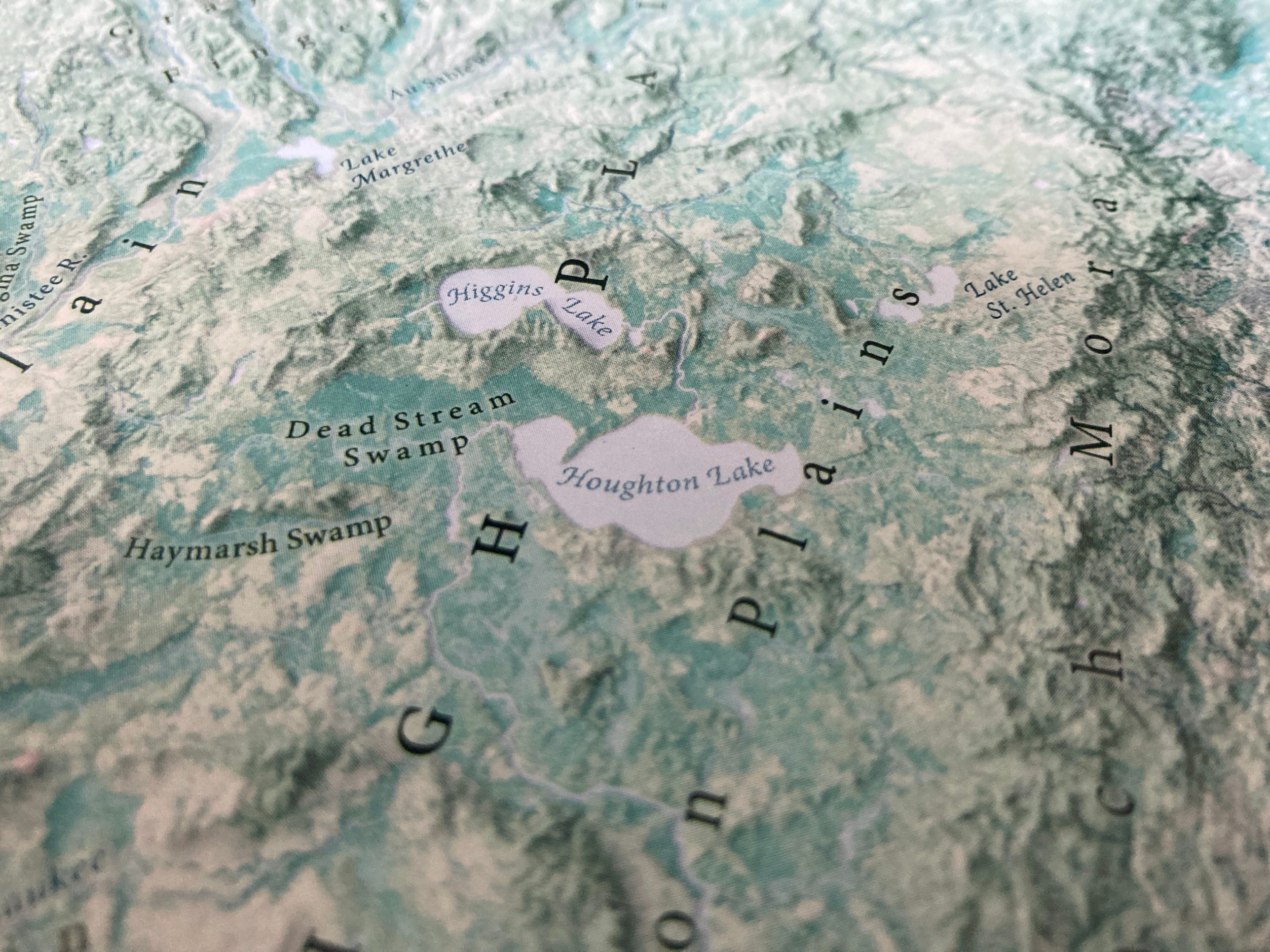
A large, detailed, and extensively-labeled map of Michigan’s various moraines, plains, mountains, hills, swamps, lakes, and more. The most thorough map of its kind; the result of a huge amount of painstaking research, with hundreds of physical features marked. It provides a rich picture of the physical terrain of the Great Lakes State.
32 × 36in, plus ½-inch white margin
![](https://freight.cargo.site/t/original/i/19b867ec10641e6426813e00b9971c4124046288ab4182a3af199d0909ed87d8/9---Med-Res-Preview.jpg)
![](https://freight.cargo.site/t/original/i/e4390a6738f8b63907add5eafee87beece62e2b4c244ec0cc7373a60382aaa95/img_4247.jpeg)
![](https://freight.cargo.site/t/original/i/af6823b97999e91b3c510649c60e7ea41701239382c5778a0ddfb66625b0d621/img_4249.jpeg)
![](https://freight.cargo.site/t/original/i/1cacff17a87989c61c3b5baf88c5afb7fc6b4a86681ce109c0895752fc1c16ce/img_4252.jpeg)
![](https://freight.cargo.site/t/original/i/8de82eb4b330fb0764d0c8068cf904d0b56d9cf1d1b6ac816a52f312a80b6b26/img_4253.jpeg)