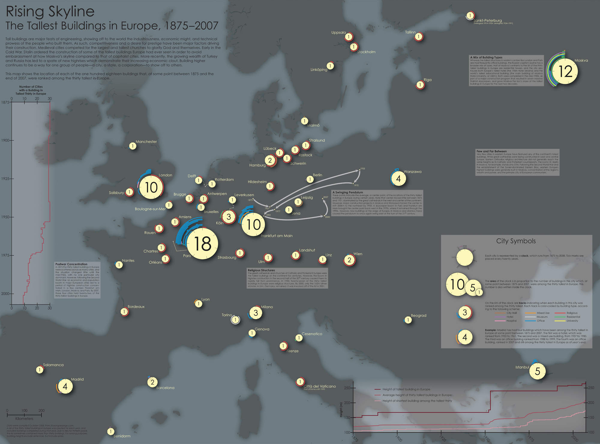
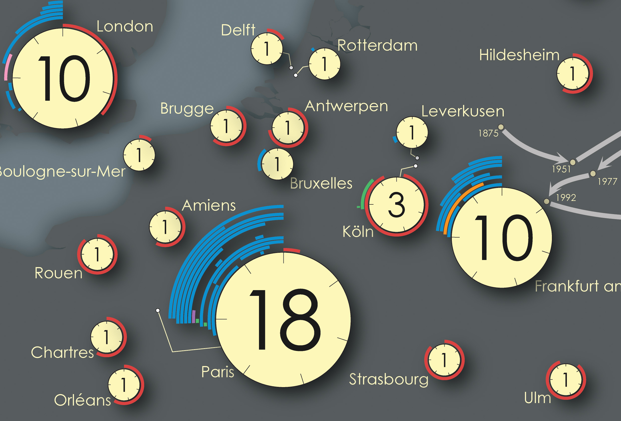
Rising Skyline
January 2009Winner of the 2008–9 National Geographic Award in Mapping
This one started out as a class project. I was taking a course on European cities, and the instructor said that, for graduate credit, I needed to do “something extra.” Fortunately, he let me do a map rather than writing a paper.
I’d had this idea sticking around in the back of my mind for a few weeks before the class assignment came up, but it was originally about mapping the change in the center of gravity of the world’s tallest buildings over the last 50 years, watching it shift from New York to the Arabian Peninsula. I shifted my focus to Europe, and realized that I could tell a larger story by showing not just the center points, but the locations of the buildings themselves.
The symbology is complex, but I think it’s approachable, easily explained, and allows the map to be rich enough to be worth looking at more than briefly. Something you could hang on your wall without it becoming rapidly boring.
If I were to do it over again, I would probably drop the graphs, as they make things too busy.