An Atlas of North American Rivers
2011–2012
(mostly)
Honorable Mention: CaGIS 2011 Map Awards
Selected: 2024 Atlas of Design
Most Unique: WLIA 2021
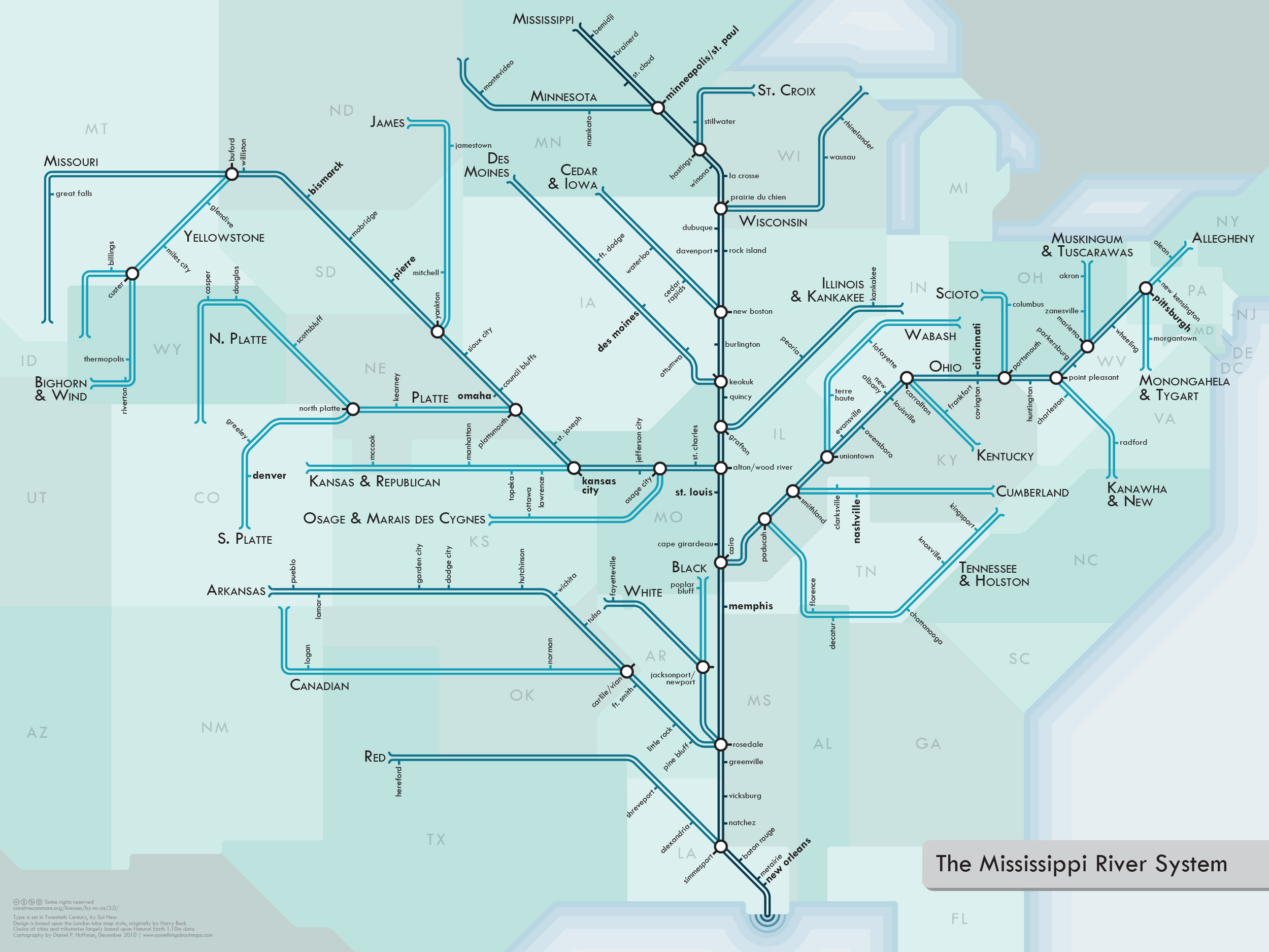
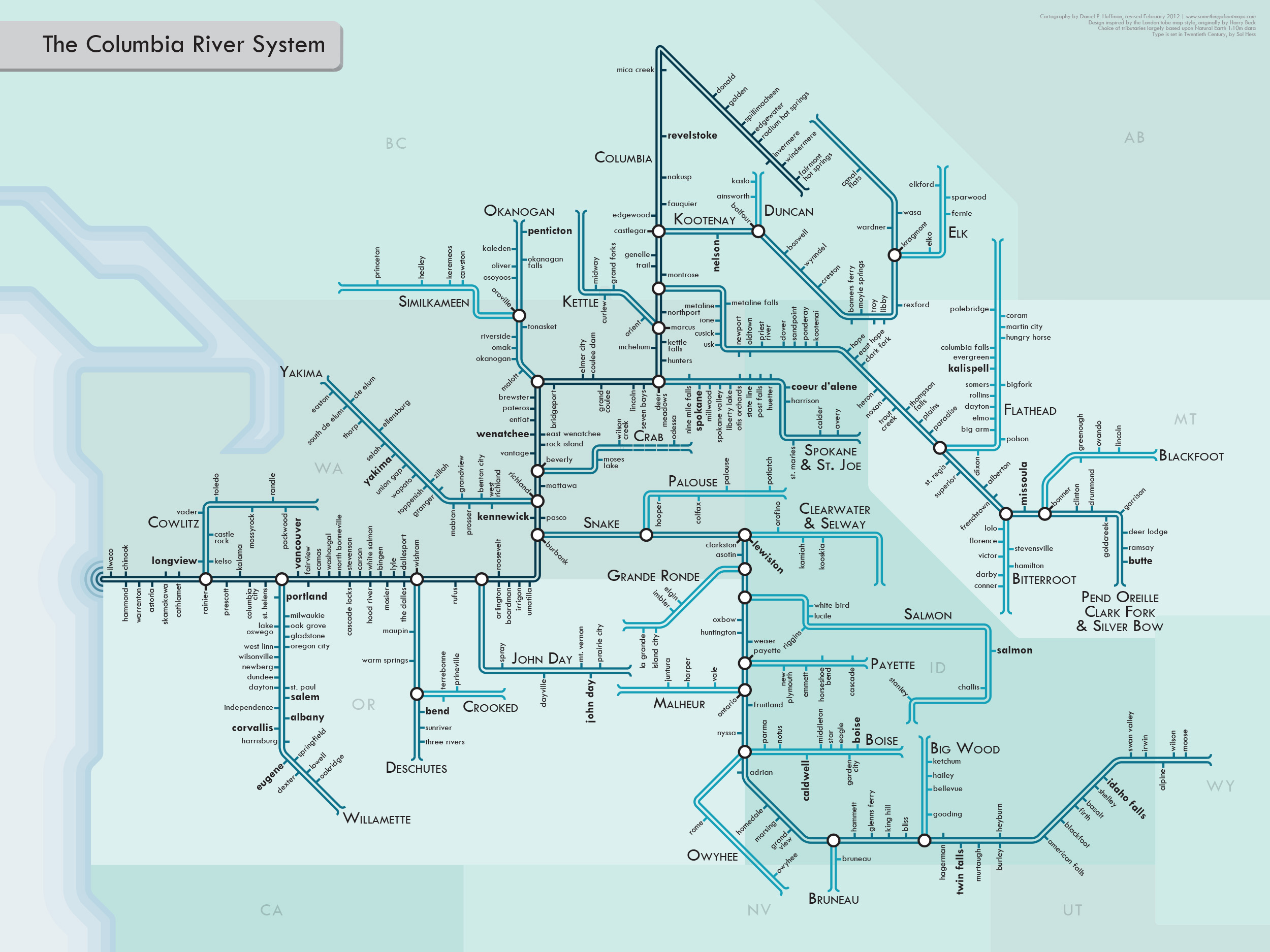
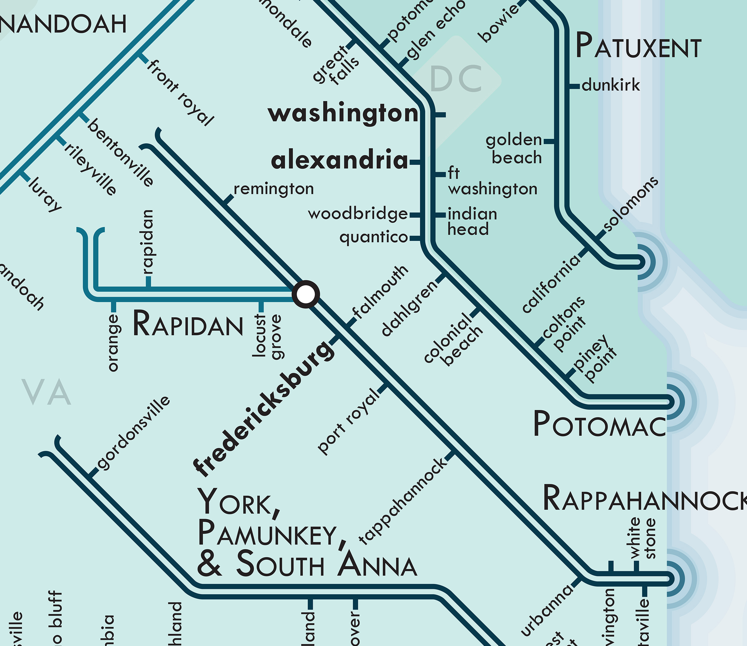
I wanted to create a series of maps that gives people a new way to look at rivers: a much more modern, urban type of portrayal. So I turned to the style of urban transit maps pioneered by Harry Beck in the 1930s for the London Underground. Straight lines, 45° angles, simple geometry. The result is more of an abstract network representation than you would find on most maps, but it’s also a lot more fun. The geography is intentionally distorted to clarify relationships. I think it helps translate the sort of visual language of nature into a more engineered one, putting the organic in more constructed terms.
For more information, visit my
blog, where you can download free PDFs of these maps or buy prints.