River Transit Maps
Natural Features, Urban LanguageAwarded Most Unique @ WLIA 2021
Honorable Mention @ CaGIS 2011
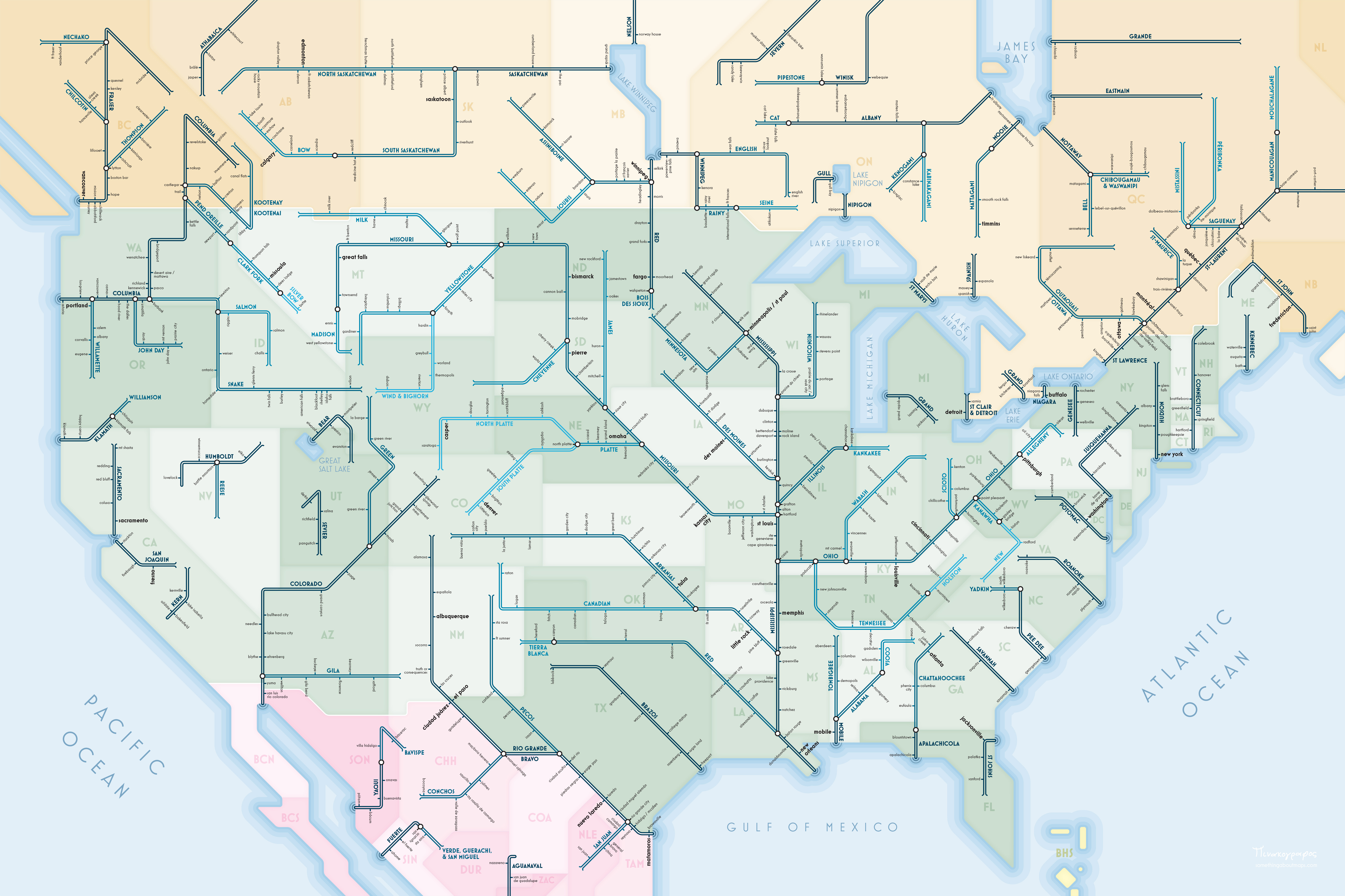
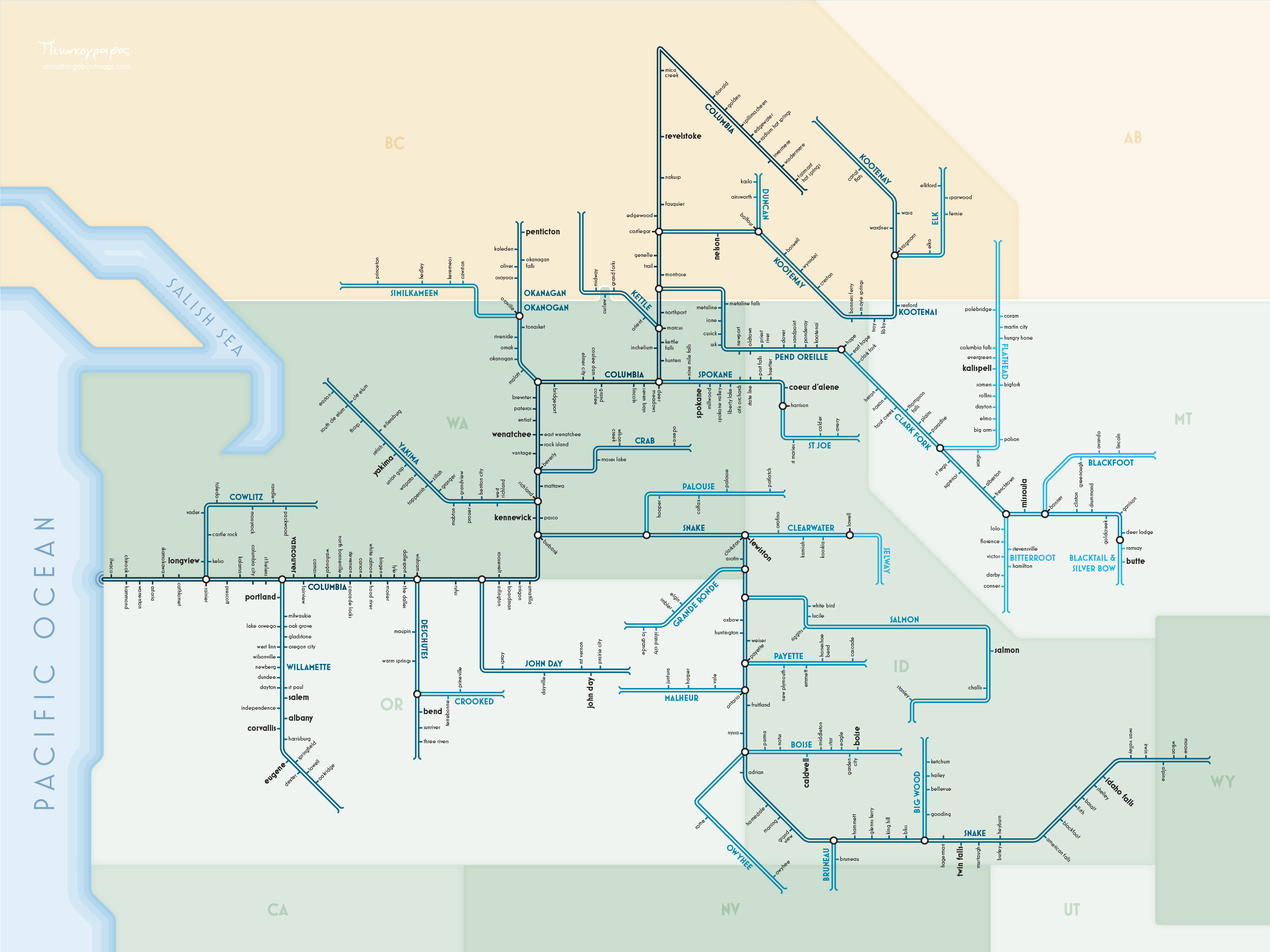
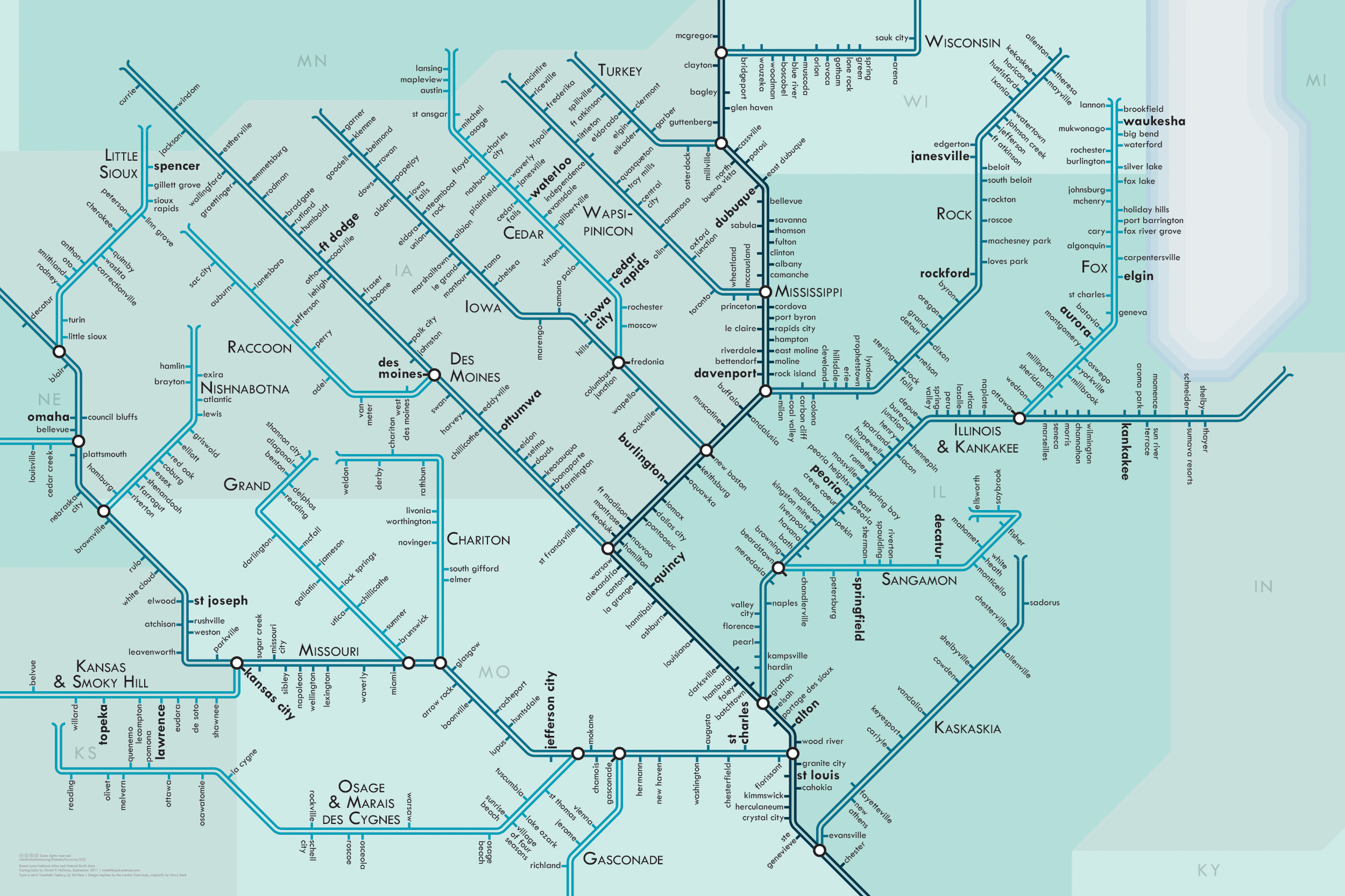
Maps of a few dozen major North American river networks rendered in the style of urban transit maps: straight lines, 45-degree angles, simple geometry. The result is more of an abstract network representation than you would find on most maps, and it’s not meant to be taken too seriously — I would not recommend actually transiting through these rivers, as many portions of them are not navigable. But they do, nonetheless, connect us.
Sizes vary. Click the link below to look through all the available rivers (and even download free PDFs!).