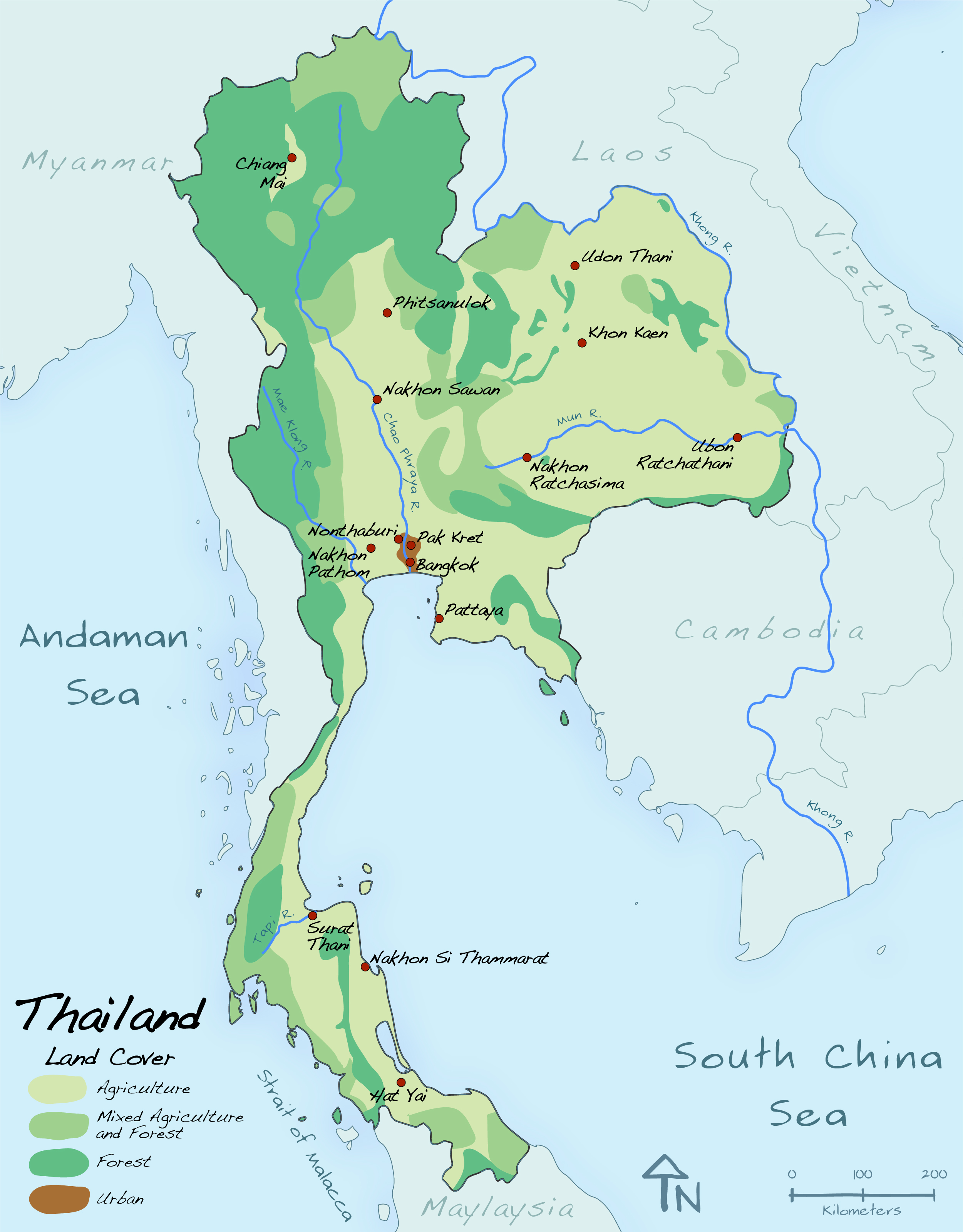
Thailand Land Cover
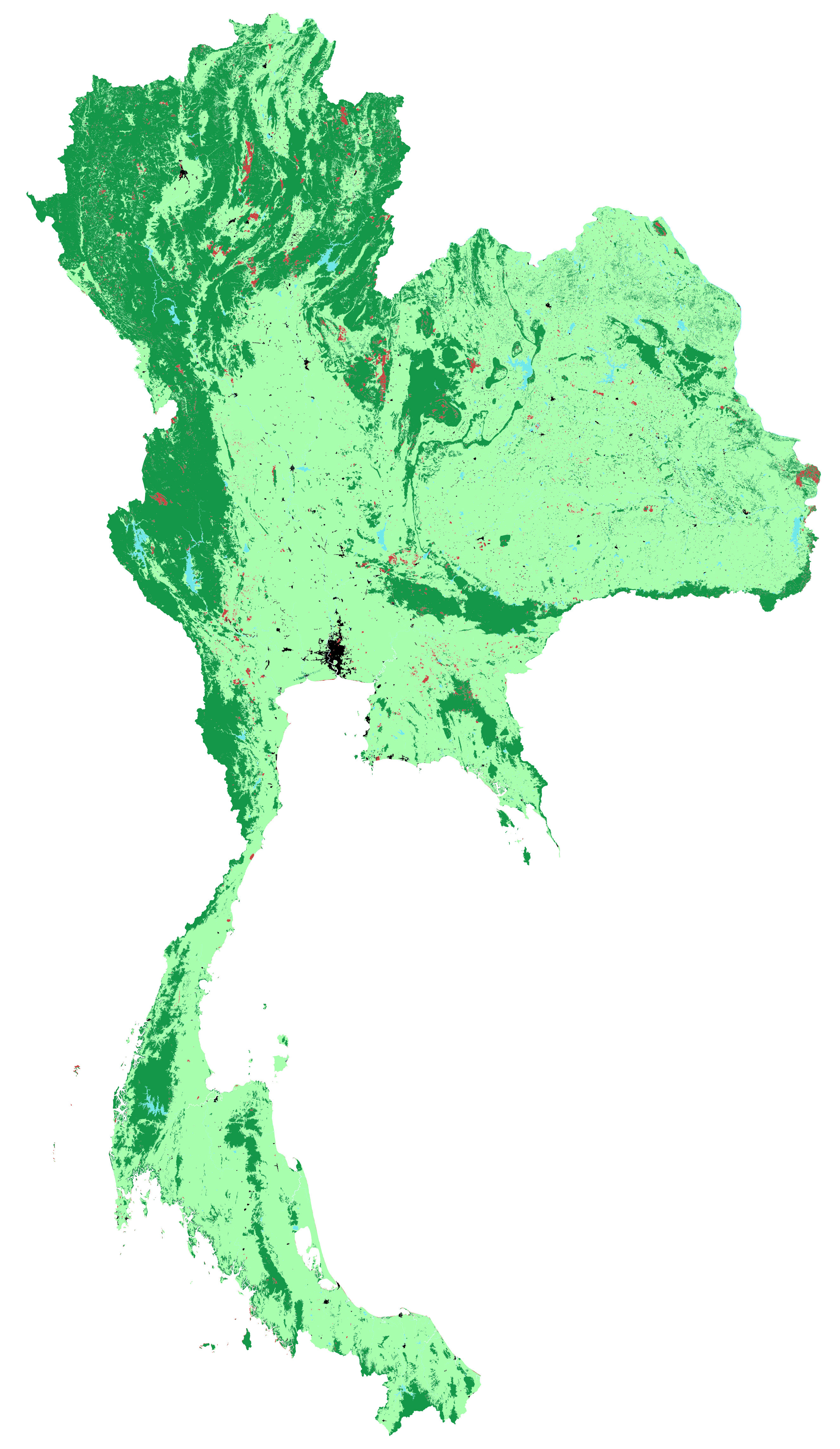
October 2009The land cover is hand-generalized, based on an extremely overdetailed vector file. That’s the second image here. I simply drew new polygons over it, eyeballing the general extent of forest, and areas where I thought forest and agriculture were fairly mixed.
When I lecture introductory cartography, I sometimes use this project as an example of how too much detail gets in the way of interpretation, and how we can clarify patterns by eliminating data. Generalization brings clarity.