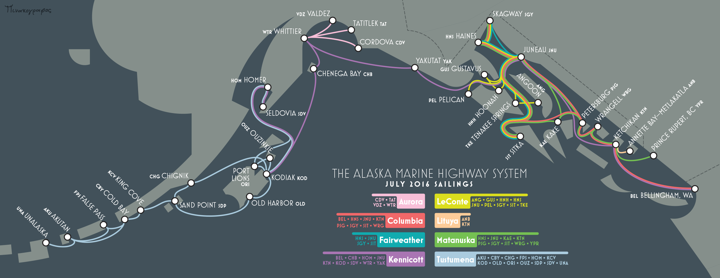
Alaska Marine Highway
December 2016Best in Category, CaGIS 2017 Map Awards
Most fun, of course, was distorting the geography. Many areas are compressed, stretched, expanded, etc. in order to best show connections. For example: in reality, Prince Rupert is closer to Skagway than it is to Bellingham.
While it was a bit outdated by the time I finished, it still was accurate enough to come in handy a couple of years later when I decided to sail the Inside Passage and needed to figure out exactly which boats went where.
The design incorporates some helpful suggestions from Cameron Booth, whose Transit Maps blog has a writeup on an earlier draft (which has some odd colors due to an exporting error on my part), including some further comments from me.